Trip Overview

Package Details

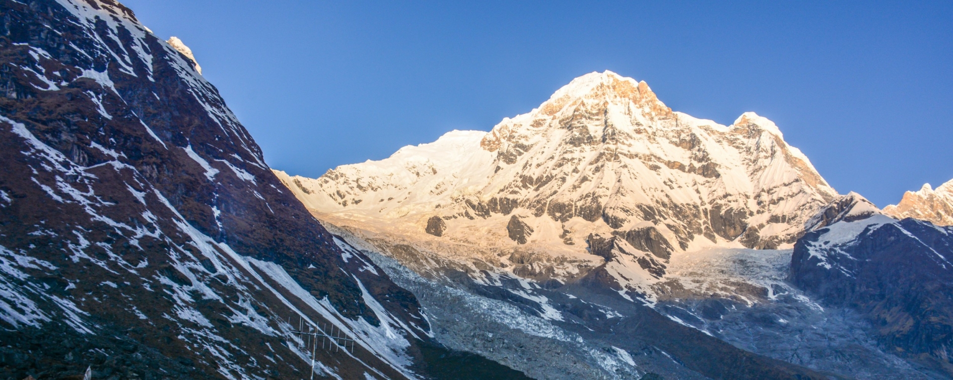
Mt. Annapurna IV is located in the heart of the Annapurna mountain range, between the summits of Annapurna II and Annapurna III, via a spectacular ridge that connects all three mountains. This ridge is an incredible wall that includes Annapurna I (8091m.), Annapurna II (7,937m.), Annapurna III (7,555m.), Annapurna IV (7,525m.), and Annapurna South (7,220m. The Annapurna range also includes the well-known Machhapuchre (fishtail 6,993m).

Among all the Annaprnas, Annapurna IV is one of the easiest Annapurnas to climb. The earliest expedition teams in the Himalayas used Annapurna IV to build up their team before ascending other formidable Himalayan peaks.

Above Camp 1, the route from Camp 2 to Camp 3 becomes steeper, necessitating the use of a fixed rope on some of the more difficult sections, including crossing a bergschrund. Camp 3 is located at the junction of North Ridge and Summit Ridge, at an elevation of 20,500 feet. It sits on Annapurna IV's "Dome" and provides an incredible view of the Summit Ridge. The climbing on this section will be extremely difficult because we will be climbing some steep sections on the Summit Ridge itself as well as traversing some steep slopes below the summit, with the possibility of encountering some rocks on the summit pyramid.
Things To Do

Itinerary & Map

Days View All Details

  • 1
    Arrival in Kathmandu airport, meet our staff then transfers to Hotel.
  • 2
    Kathmandu free and preparation.
  • 3
    Official works for expedition and briefing by officer of Ministry of Tourism.
  • 4
    Drive to Khudi 790m. and walk to Bhulbhule. Overnight.
  • 5
    Besisahar – Nagdi
  • 6
    Nagdi – Jagat 1314m.
  • 7
    Jagat – Dharapani 1943m.
  • 8
    Dharapani – Chame 2713m.
  • 9
    Chame – Pisang 3185m.
  • 10
    Pisang – Sabche Khola.
  • 11
    Sabche Khola – Annapurna 4th Base camp 4500m.
  • 12-28
    Climbing Period Annapurna 4th 7525m. Expedition.
  • 29
    Clean up Base Camp – Mananag 3351m.
  • 30
    Manang – Thorong – La Phedi 4010m.
  • 31
    Phedi – Thorong La pass 5416m. – Muktinath 3802m.Overnight.
  • 32
    Muktinath – Jomsom 2713m.
  • 33
    Jomsom – Kalopani 2530m.
  • 34
    Kalopani – Tatopani 1189m.
  • 35
    Tatopani – Beni 820m. Overnight at Lodge.
  • 36
    Beni – Pokhara 915m. by Bus and transfer to Hotel.
  • 37
    Drive to Kathmandu by tourist Bus then transfer to Hotel.
  • 38
    Kathmandu free.
  • 39
    Kathmandu free.
  • 40
    Last minute, transfer to airport for onward journey.
Something good about us

Client Reviews

There are no reviews.

Write a review

Leave Your Review


    captcha
    Quick facts
    • Elevation:
      24,688 ft/ 7,525 meter
    • Location:
      Everest region of Nepal
    • Latitude:
      28° 32′ 20.4″ N
    • Longitude:
      84° 5′ 13.2″ E
    • Best season for climbing:
      Spring & Autumn
    • Year First Climbed:
      1955 via the North Face and Northwest Ridge
    • First Climber(s):
      German expedition led by Heinz Steinmetz,
    • Convenient Center(s):
      Pokhara
    • Entry:
      Khuldi
    • Exit:
      Beni Bazaar
    • Nearest Major Airport:
      Kathmandu (minor: Pokhara)
    • Easiest Summit Route:
      North Face and Northwest Ridge
    • Itinerary type:
      Fixed / Customized
    • Accommodations:
      Lodge / Camping
    • Trek grade:
      Strenuous
    • Total days:
      36 + 4 = 40days
    • Total royalty:
      US$ 2,000 up to 7 members & additional each US$ 300
    • Garbage deposit:
      US$ 3000 refundable
    • Air rescue deposit:
      US$ 3000.00 for a group (Refundable if not used)
    • Air fare:
      Current fare applicable if required
    • Liaison Officer Charge:
      Depending on the size of group
    • Climbing Guide fee:
      Depending on the size of group
    5
    Tough and Technical: Tough and Technical
    Subscribe to our

    Newsletter

    Subscribe to our newsletter for latest updates